Route of the Hiawatha
About the Trail
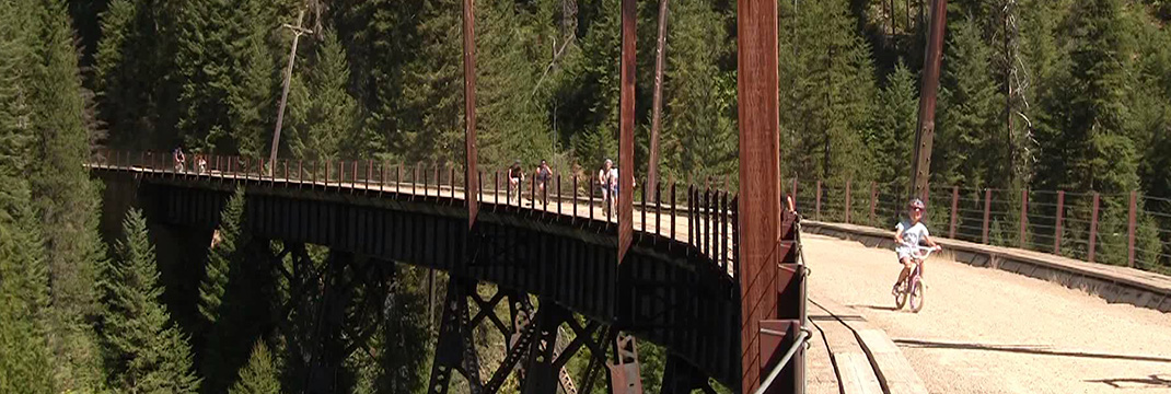
This award winning non-motorized, developed, alpine trail is known for its beauty. The trail passes through nine tunnels and over seven high safe trestles on its way from the old abandoned town of Taft. The compact dirt and gravel trail begins with the 1.6 mile St. Paul Tunnel in Montana and exits into Idaho going along a gentle 2% grade to the Pearson Trailhead. The trail is equipped with frequent outhouses, tables and interpretive kiosks. The views from the Hiawatha from the trestles and overlooks are outstanding and change with the season that starts as snow leaves in late spring until it closes in early fall.
In order to ride the Hiawatha you need a helmet, lights and water. The Hiawatha requires a user fee and there is a separate fee if you wish to use the shuttle. Dogs are not allowed on the trail. If you want to camp those spaces are located at the base of the Hiawatha extending to from Pearson into the National Forest. There are unimproved sites along the beautiful North Fork of the Saint Joe River and improved sites a few miles down river or you may decide to head to Avery for very limited services or back to the Silver Valley or Montana for full services.
Skill Level: Easy beginner downhill and moderate uphill
Social Media Photos: #trailofthehiawatha
Directions to the Trail
There are two ways to get to the Hiawatha:
- Down I-90 crossing over Lookout Pass from Idaho until you reach the Taft exit.
- The second way is to go through Wallace and over Moon Pass to the bottom of the Hiawatha at the Pearson Trailhead and either take the shuttle or peddle to the top and coast down.
Related Agencies
Contact Lookout Pass Ski and Recreation Area at (208) 744-1301 or online ridethehiawatha.com.
Trail is open
Purchase the digital GPS file(s) for this trail
This digital product includes an Avenza Map of this trail. You can use the Avenza Map on your smart-phone while offline to track your progress and annotate your trip. This download also includes GPS data files for use in other handheld/portable GPS. (ESRI Shapefiles, GPX, GeoJSON, KML)

Route of the Hiawatha Digital Map
$5.00
Description
This digital product includes an Avenza Map PDF of this trail. You can use the Avenza Map PDF on your smart-phone while offline to track your progress and annotate your trip. This download also includes a ZIP file containing GPS data files for use in other handheld/portable GPS applications such as Google Maps (KML), Garmin (GPX) or other GIS Software. (Shapefiles, GeoJSON)
File size: 3.0 MB zip file
Trail maps include:
- Route of the Hiawatha
Get your Avenza Map App here:


Additional Routes
off the Route of the Hiawatha


