Route of the Olympian
About the Trail
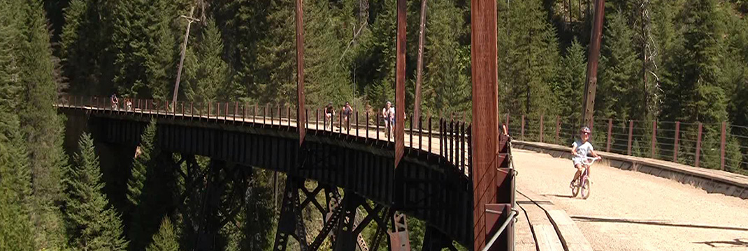
The 31 mile Route of the Olympian is located just over the Idaho State line and is, separate but a continuation, of the Hiawatha Trail on the old Milwaukee rail bed. The first five miles is human powered sports in summer crossing through tunnels and over the very scenic Dominion trestle. The Olympian from there on is multiple-use on into St. Regis. The trail follows the St. Regis River which also separates the trail from Interstate 90 that parallels much of this underused trail. Unlike the Hiawatha there is no cost to use the Olympian. Even if you don’t ride the entire trail peddle out to the old Dominion trestle and enjoy the sense of awe with the spectacular view from the “top of the world.” The Olympian represents part of the larger trans American trail system which in Washington State is the Iron Horse and John Wayne trail and in Idaho under the Friends of the Coeur d’ Alene Trails is reestablished as the Milwaukee and the Milwaukee scenic Alternate Route. Under the US Forest Service then as the Hiawatha.
Skill Level:Beginner/Flat
Directions to the Trail
Head to the Hiawatha located at the Taft exit in Montana and park at the far north end of the parking lot and go north on the rail line.
Trail is open
Purchase the digital GPS file(s) for this trail
This digital product includes an Avenza Map of this trail. You can use the Avenza Map on your smart-phone while offline to track your progress and annotate your trip. This download also includes GPS data files for use in other handheld/portable GPS. (ESRI Shapefiles, GPX, GeoJSON, KML)

Route of the Olympian Digital Map
$5.00
Description
This digital product includes an Avenza Map PDF of this trail. You can use the Avenza Map PDF on your smart-phone while offline to track your progress and annotate your trip. This download also includes a ZIP file containing GPS data files for use in other handheld/portable GPS applications such as Google Maps (KML), Garmin (GPX) or other GIS Software. (Shapefiles, GeoJSON)
File size: 3.0 MB zip file
Trail maps include:
- Route of the Olympian
Get your Avenza Map App here:


Additional Routes
off the Route of the Olympian


